-
07971 943934
kingstoneandthruxton parish council
kingstoneandthruxton, parish council
OgImage:
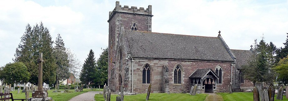
Kingstone and Thruxton
The parishes of Kingstone and Thruxton are
situated south west of Hereford and centrally between the Wye Valley
and the Golden Valley. It has an area of 991 hectares and is part of the Wormside Ward. The boundary runs along Cage Brook to the north above the
Madley Earth Satellite Station. As far as Pool Farm.
Thruxton to the east and Thruxton Valletts wood to the south. Its western boundary includes Gooses Foot Industrial Estate and Farm. Kingstone was recorded in the Domesday Book but was in existence long before that. It was a small agriculture village until the Second World War.
At the time of the Domesday Book it had about 50 inhabitants. By the time of the first census in 1801 the population had risen to 372 and by 1851 had peaked at 510. In 1901 it had fallen to 347 and before the War in 1931 was down to 292 as agriculture mechanised. In 1951 the population had risen dramatically to 1,161 and in the last census 1,331 lived in the Group Parish. The population density is 1.34 persons per hectare against a county figure of 0.80.
Thruxton’s population by comparison was 1801 – 75, 1851 – 71, 1901 – 67 and 1931 – 49.
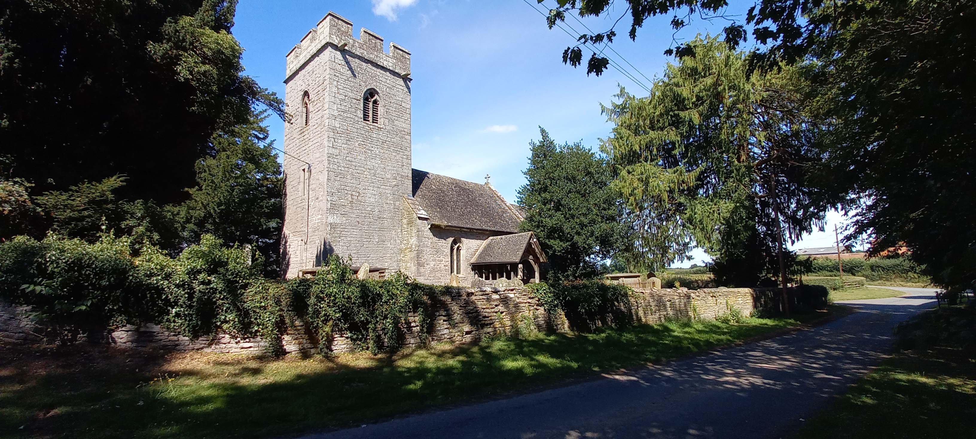
St Bartholomew's Church, Thruxton
During the War the construction of the Madley Airfield (with a large amount of the site and buildings within the Kingstone boundary) increased the local population. Following the War many stayed, being housed in converted military buildings. This huge increase in population has dramatically altered the character of the Village. Initially the building of Green Lane then Coldstone Cross in the early 50’s re-housed those accommodated in the temporary buildings. Kingstone is now a commuter community with the large majority travelling to work outside the village. Less than 7% are now employed in agricultural work.
Latest Parish News
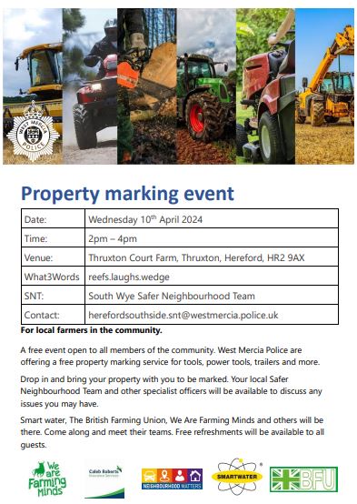
Neighbourhood Matters - Property Marking Event
Kingstone and Thruxton Parishes
27
March 2024

Defibrillator and CPR Training
22
March 2024

The Parish Council confirmed that they are happy to promote and organise Defibrillator and Cardiopulmonary Resuscitation (CPR) training. If you want to attend then please register your interest with Councillor Thorne at lynne.thorne84@gmail.com so that numbers can be established and a training date booked.
Kingstone & Thruxton
°C
mph
FRI
 °
°
°
°
SAT
°
°
SUN
°
°
MON
°
°
TUE
°
°